©

Itinerary Terme Di Valdieri A Casterino Ruisseau 3

The Trinità Di Valdieri to Casterino stages

Ajouter aux favoris

The spa resort of the upper Gesso valley is the natural gateway to this classic mountain itinerary, designed for the trained and well-equipped hiker, linking several emblematic sites and passages in the Alpes-Maritimes Nature Park, dominated by the Monte Argentera massif.

Between peaks over 3,000 metres high, in the heart of protected flora and fauna, three stages and two nights in a refuge offer total immersion in the Alpine environment: trails through forests, mountain pastures, passes and alongside lakes.

The arrival at Trinità di Entracque, another access route to the Route from the Gesso Valley, opens the ascent towards the State border, the Roya Valley and the Côte d’Azur.

1. Terme di Valdieri - Refuge CAI Genova Figari

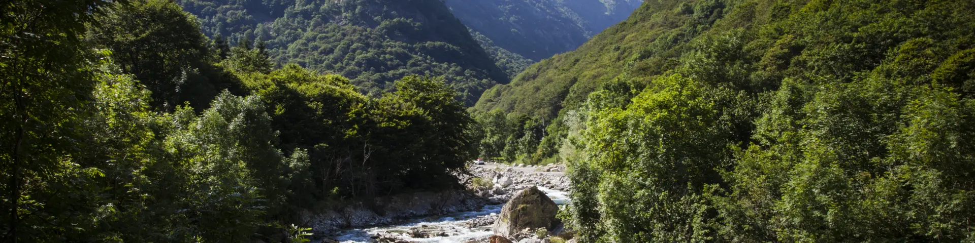
Terme di Valdieri is the western gateway to the RivierAlp Way. It is the first of three stages in the Valle Gesso leading to Trinità d’Entracque and on to France. A classic Alpine trail in its entirety, it follows the route of the Grande Traversée des Alpes Maritimes, as well as part of the Sentiero Italia.

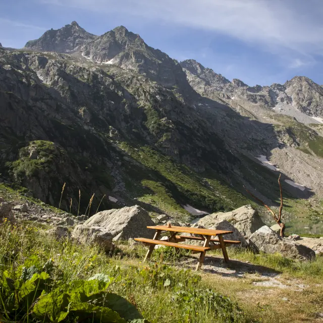
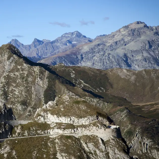
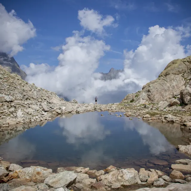
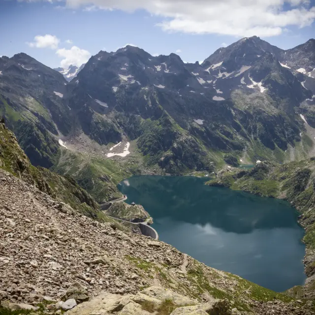
It’s an easy climb to the Refuge Morelli and, after a break, to the Col du Chiapous at 2,500 metres, with the imposing mass of Mount Matto in the background. You then switch to the basin that houses the Chiotas dam, skirting the foothills of the Argentera, whose northern and southern peaks are well over 3,000 metres high.

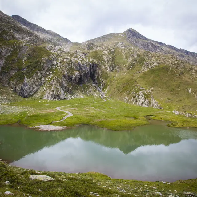
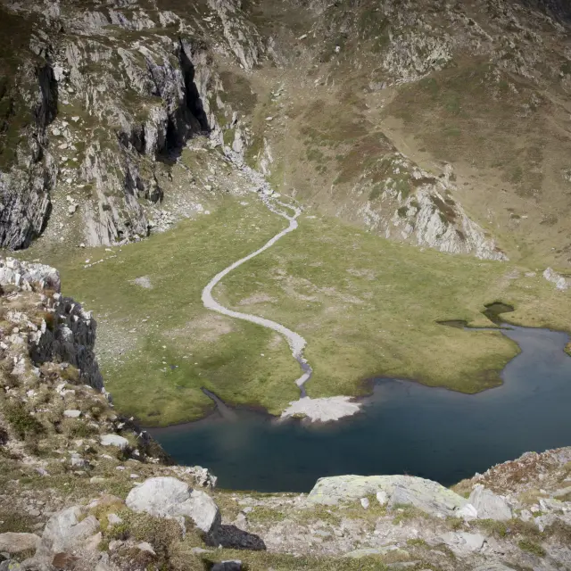
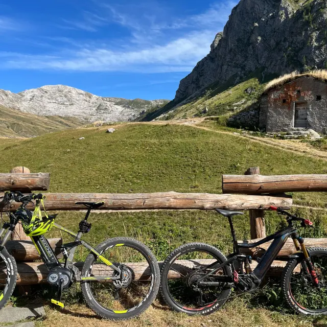
Once you have reached the artificial lake, you walk along the top of the dam, then along the opposite side of the Vallon de la Rovina. Taking the unpaved road along the eastern side of the lake, you arrive at the CAI Genova Figari Refuge.

2. CAI Genova Figari refuge in San Giacomo Di Entracque

RivierAlp‘s second “western” stage, and another pass at almost 2,500 metres: the Col de Fenestrelle, a classic Alpes Maritimes hike in the heart of the Park. From the refuge, you leave behind the artificial Chiotas lake and head into the Gesso della Barra valley. Near the pass is a classic piece of Alpine military archaeology: the stone ruins of the Ricovero Fenestrelle, built in 1888 and used during the Second World War.

The structure could accommodate squads of ten men, to guard the passage between the two valleys for anti-French defence purposes. On a path towards the bottom of the valley, you lose 600 metres of ascent; as you descend to the opposite side, you can see the Soria Refuge.

The route, which begins on scree, then winds through pastures and crosses the Gias Balmetta and Alvè, where it is not unusual to see wild ungulates grazing. From the valley floor, an hour’s walk on an easy track takes you down to the small hamlet of San Giacomo di Entracque.

3. San Giacomo Di Entracque in Trinità Di Entracque

This splendid route follows the ninth stage of the Grande Traversée des Alpes Maritimes (GTAM), which is also part of the Sentiero Italia.

It is well signposted and maintained, with a route that offers a splendid immersion in nature. After descending along the torrent, you climb up to the panoramic Colle Vailetto, admiring the majestic, wild peaks: Punta Casasco, Punta Olivazzo, Rocca Garner and Monte Barra.

The descent, the opposite of the gentle, relaxing ascent, takes in Tetto Airetta and the Esterate Refuge, from where you finally reach the picturesque hamlet of Trinità di Entracque. The buildings here include the charming little Church of the Holy Trinity and the historic Locanda del Sorriso, which welcomes hikers and mountain bikers for a meal or a stay, before the climb up to Colle del Sabbione, from where you descend towards France.

4. Trinità Di Entracque at Bivouac CAI Speranza

The Col du Sabion is an impressive border crossing betweenItaly and France, right next to the small Lac de la Vacca, at an altitude of over 2,200 metres. The approach includes a long and pleasant first section on a passable track through beech woods and forests.

Shortly after the start, the grey stone Pont du Suffiet offers a fine view of the bubbling waters of the giant cauldron carved out by the Bousset torrent below. The road then becomes a path through the unspoilt pastures, still frequented by chamois, of the Gias de l’Adreit and Valera, before tackling a fine ascent in pure Alpine style in the Vallon du Sabion.

The narrow path rises between grassy slopes and rocky outcrops towards the spectacular alpine saddle, narrowing against the wall at certain points. The CAI Speranza bivouac, overlooking the waters of the lake, is as spartan as it is safe; with no drinking water, it is suitable for hikers equipped for a classic night in the mountains.

5. CAI Speranza bivouac in Casterino

The stage leaves the Vallon du Sabion and the bivouac to climb a few steep switchbacks to the pass and cross over to the French side. Immediately, vast alpine meadows open up, dotted with vestiges of military archaeology, defensive works dug into or clinging to the rock, placed to defend the passage.

The descent to Casterino is one of the most exciting: short, easy and pleasant, right in the heart of the Mercantour National Park, surrounded by imposing peaks and sunny slopes that level out near the Baisse de Peïrefique, at an altitude of 2,000 metres.

It is on this wide and busy grassy saddle, along the important old military road to Italy, that the trail crosses the RivierAlp route from Limone Piemonte, via the Fort de Giaure. There’s just over an hour to go before the finish, all downhill among the conifers, towards the few houses at the bottom of the Casterino valley, the heart of the Mont Bego archaeological area.

You will also like...

Share this tour!